






Topcon CR-P1 for BIM and Scan-to-BIM Projects Malaysia

Topcon CR-P1 for BIM and Scan-to-BIM Projects Malaysia
Introduction
Building Information Modelling (BIM) and reality capture technologies are increasingly relevant to construction, architecture, engineering and facility management workflows in Malaysia.
For projects involving existing buildings, renovation, industrial facilities and infrastructure, obtaining reliable information about physical site conditions is an important step before creating or updating digital models.
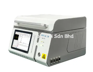
The Topcon CR-P1 3D Laser Scanner is designed for three-dimensional reality capture and point cloud data collection.
For Malaysian surveying contractors, BIM consultants, architects and engineering companies, the Topcon CR-P1 may support Scan-to-BIM workflows by providing spatial information about visible building surfaces and structures.
This guide explains how 3D laser scanning supports BIM projects, the differences between point clouds and BIM models, and what Malaysian buyers should consider before investing in reality capture equipment.
What Is BIM?
Building Information Modelling, commonly known as BIM, is a process for creating and managing digital information about buildings and infrastructure assets.
A BIM model may contain geometric information together with additional data about building components, materials, systems and asset relationships.
BIM workflows can support design coordination, construction planning, renovation, asset management and facility operations.
However, BIM is not simply a three-dimensional drawing. It involves structured information, defined project requirements and collaboration between project participants.
What Is Scan-to-BIM?
Scan-to-BIM is a workflow that uses three-dimensional reality capture data as a reference for creating or updating a Building Information Model.
A typical Scan-to-BIM process includes:
1. Defining project requirements and deliverables.
2. Planning the site survey and scanning locations.
3. Capturing three-dimensional point cloud data.
4. Registering and checking the collected scans.
5. Preparing the point cloud for modelling.
6. Creating BIM objects using suitable software.
7. Reviewing model completeness and geometric accuracy.
8. Delivering the model and supporting documentation.
The point cloud represents measured spatial information, while the BIM model is created through additional interpretation and modelling work.
A 3D laser scanner does not automatically produce a complete, verified BIM model.
How Can the Topcon CR-P1 Support Scan-to-BIM?
The Topcon CR-P1 is a terrestrial 3D laser scanning instrument intended for reality capture applications.
Its role in a Scan-to-BIM project is to collect spatial measurements that can form a geometric reference for further processing.
Potential applications include the following.
1. Existing Building Documentation
For older buildings or properties with incomplete drawings, laser scanning can help record visible building geometry.
This information can support the preparation of digital models reflecting accessible site conditions.
2. Renovation and Refurbishment
Architects and engineers may require updated building dimensions before redesigning an existing space.
Point cloud information can support the review of wall locations, columns, ceiling geometry and other visible features.
3. Industrial Plant Modelling
Factories and industrial facilities may require spatial documentation before equipment upgrades or layout modifications.
Laser scanning can support the creation of geometric references for accessible equipment, exposed pipework and surrounding structures.
4. Construction Coordination
Point cloud information can help project teams compare recorded site conditions with proposed designs.
Additional software and verification are required for model comparison and quality assurance.
5. Facility Management Documentation
Processed scan data and BIM models may contribute to digital asset documentation when combined with verified equipment and facility information.
Topcon CR-P1 Point Cloud Data vs BIM Model
Point clouds and BIM models serve different purposes.
Point Cloud Data
A point cloud contains collections of three-dimensional measurement points representing scanned surfaces.
It provides geometric information about the environment recorded during the survey.
Building Information Model
A BIM model contains structured digital objects representing building components and their associated information.
For example, a wall in a BIM model may be represented as an object with defined geometry and additional properties.
The conversion from point cloud data to BIM objects usually requires modelling software, human interpretation and quality checking.
Therefore, Malaysian buyers should not assume that purchasing a 3D laser scanner automatically provides a complete Scan-to-BIM solution.
Typical Scan-to-BIM Workflow for Malaysian Projects
Step 1 - Define the Project Scope
The client and survey team should agree on the required building areas, deliverables, tolerances, coordinate reference and modelling requirements.
Step 2 - Plan the Scanning Survey
The surveyor identifies suitable scanning positions and considers obstructions, access limitations and site safety.
Step 3 - Establish Survey Control Where Required
Depending on the project, a total station or another surveying instrument may be used to establish reference control.
Step 4 - Capture the Building Geometry
The laser scanner collects spatial information from accessible positions.
Multiple scanning setups may be necessary to cover different rooms, floors and building areas.
Step 5 - Register the Point Cloud
Individual scans are aligned using appropriate registration methods and compatible processing software.
Step 6 - Verify Data Quality
The project team reviews registration quality, scan coverage, project tolerances and missing areas.
Step 7 - Prepare the BIM Model
BIM specialists use the processed point cloud as a geometric reference to create relevant building elements.
Step 8 - Review and Deliver
The final model should be checked against the agreed project requirements before delivery.
The exact Topcon CR-P1 data processing workflow, supported software and file formats must be confirmed using current official manufacturer documentation.
Topcon CR-P1 for Existing Building BIM in Malaysia
Existing buildings may not have complete or updated architectural and engineering drawings.
This can create difficulties during renovation, equipment installation and facility modifications.
3D laser scanning can help project teams document visible geometry and create a spatial reference for further modelling.
Potential projects include:
Commercial office renovations.
Shopping mall refurbishment.
Factory expansion.
Warehouse layout modification.
Hospital facility upgrades.
Educational building renovations.
Industrial plant maintenance planning.
Actual project suitability depends on survey accuracy requirements, access conditions, deliverables and technical resources.
Scan-to-BIM for Industrial Facilities and Factories
Industrial facilities often contain complex layouts involving machinery, structural columns, exposed piping and building services.
Traditional point-by-point measurement may be time-consuming when extensive visible geometry must be documented.
A 3D laser scanning workflow can capture spatial information for engineering review and modelling.
For example, an engineering contractor planning to install new production equipment may require a geometric record of the surrounding factory area.
A processed point cloud can support clearance reviews and layout planning.
However, optical laser scanning cannot directly reveal hidden services, concealed structural elements or internal machinery conditions.
Additional measurements and inspections may be necessary.
Topcon CR-P1 vs Total Station for BIM Projects
A total station and a 3D laser scanner can complement each other in BIM-related surveying projects.
Total stations are commonly used for survey control, setting out, alignment and selected point measurements.
3D laser scanners are used to capture large quantities of spatial information representing visible surfaces.
For a Scan-to-BIM project, survey control may be established using a total station, while laser scanning captures the existing building geometry.
The appropriate workflow depends on the project's accuracy requirements, available instruments and survey methodology.
Why Point Cloud Accuracy and Registration Matter
A detailed-looking point cloud is not automatically an accurate survey deliverable.
Survey quality depends on several factors, including:
1. Instrument performance.
2. Scanning positions and coverage.
3. Survey control quality.
4. Registration methodology.
5. Environmental and surface conditions.
6. Data processing procedures.
7. Independent quality checks.
Project teams should define measurable acceptance criteria before scanning begins.
Accuracy claims for the Topcon CR-P1 should be based on verified manufacturer specifications and suitable project testing.
Software Requirements for Scan-to-BIM
3D laser scanning projects generally require software for processing, registering, reviewing and exporting point cloud information.
Additional BIM authoring software may be required to create structured building models.
Before purchasing a Topcon CR-P1, Malaysian buyers should confirm:
1. Supported point cloud processing software.
2. Available registration workflows.
3. Supported export formats.
4. Compatibility with the intended BIM software.
5. Computer hardware requirements.
6. Software licensing and maintenance costs.
7. Training and technical support arrangements.
Specific CR-P1 software compatibility and supported data formats must be verified with the manufacturer or relevant supplier.
Who Should Consider the Topcon CR-P1 in Malaysia?
Potential customers include:
Licensed land surveyors.
Building survey contractors.
BIM consulting companies.
Architectural practices.
Civil and structural engineering consultants.
Mechanical and electrical engineering contractors.
Industrial plant engineering teams.
Construction companies.
Facility management organisations.
Infrastructure documentation contractors.
Companies should evaluate their expected project volume, required deliverables and ability to process scan data before investing.
Important Buying Considerations
Before selecting a 3D laser scanner for BIM projects, consider the following.
Project Requirements
Determine whether the work involves basic spatial documentation, as-built drawings or detailed BIM modelling.
Accuracy Requirements
Confirm that the proposed equipment and survey workflow can meet the specified tolerances.
Site Conditions
Consider building size, access restrictions, obstructions and environmental conditions.
Software Compatibility
Verify that the instrument's data can be processed using the intended software workflow.
Training
Operators should understand scanning methods, registration, survey control and quality checking.
Total Ownership Cost
Evaluate equipment, software, training, data processing, maintenance and support requirements.
Topcon CR-P1 Malaysia - Product Enquiries
MTM Precision Sdn Bhd supplies surveying instruments and provides surveying instrument service and calibration support in Malaysia.
Customers interested in the Topcon CR-P1 3D Laser Scanner for BIM, Scan-to-BIM, building documentation or industrial reality capture applications may contact MTM Precision to discuss their requirements.
Product availability, quotation arrangements, software compatibility, supply conditions and technical support are subject to confirmation.
The Topcon CR-P1 is not represented as a ready-stock product at MTM Precision.
Frequently Asked Questions
Q1. What is Scan-to-BIM?
Scan-to-BIM is a workflow that uses three-dimensional reality capture data as a reference for creating or updating a Building Information Model.
Q2. Can the Topcon CR-P1 be used for BIM projects?
The Topcon CR-P1 is intended for 3D reality capture. Its point cloud data may support BIM workflows, subject to suitable processing software, verified compatibility and project requirements.
Q3. Does the Topcon CR-P1 automatically create BIM models?
No. Laser scanning collects spatial measurements. Creating structured BIM models generally requires additional software, interpretation, modelling and verification.
Q4. What is the difference between a point cloud and a BIM model?
A point cloud represents measured three-dimensional points, while a BIM model contains structured digital building objects and associated information.
Q5. Can Scan-to-BIM be used for old buildings?
Yes. Scan-to-BIM can support documentation and modelling of existing buildings, particularly where original drawings are incomplete or outdated.
Q6. Is 3D laser scanning useful for factories?
It can support documentation of accessible factory layouts, machinery surroundings and exposed building services for engineering planning and modelling.
Q7. Is a total station still required for Scan-to-BIM?
Not every project requires a total station, but survey control instruments may be useful or necessary depending on accuracy and coordinate reference requirements.
Q8. Can point cloud data be imported into BIM software?
Many BIM workflows can use point cloud data, but supported formats, conversion procedures and compatibility must be confirmed for the specific software and scanner workflow.
Q9. Does laser scanning detect concealed pipes or cables?
No. Conventional optical laser scanning records visible surfaces and cannot directly detect concealed pipes, hidden cables or buried services.
Q10. What should Malaysian companies consider before purchasing a 3D laser scanner?
They should review accuracy requirements, software compatibility, operator training, project demand, processing resources and long-term ownership costs.
Q11. Where can I enquire about the Topcon CR-P1 in Malaysia?
Contact MTM Precision Sdn Bhd in Puchong, Selangor, to discuss the intended application and request confirmation of product and quotation arrangements.
Contact MTM Precision
MTM Precision Sdn. Bhd.
Showroom & Service Centre
No. 29-1 & 29-2, Jalan Bandar 18,
Pusat Bandar Puchong,
47160 Puchong, Selangor, Malaysia.
Website: www.mtmpre.com.my
Email: mtmpre@yahoo.com
WhatsApp: +6016-660 7346
MTM Precision welcomes surveying instrument enquiries from Kuala Lumpur, Selangor, Johor, Penang, Perak, Negeri Sembilan, Melaka, Pahang, Terengganu, Kelantan, Kedah, Perlis, Sabah and Sarawak.
SEO Meta Description
Explore Topcon CR-P1 for BIM and Scan-to-BIM projects in Malaysia. Learn about point cloud surveying, building modelling, workflows and buying considerations.
Internal Linking Suggestions
1. Topcon CR-P1 3D Laser Scanner Malaysia - Features, Applications and Buying Guide
2. Topcon CR-P1 3D Laser Scanner for Building Survey and As-Built Documentation Malaysia
3. Topcon Total Station Malaysia - Buying Guide
4. Topcon GM-55 vs GM-65 Total Station Malaysia
5. Topcon GT-1201 Robotic Total Station Malaysia
6. Total Station Calibration Malaysia
7. Total Station Repair and Service Malaysia
8. 3D Laser Scanner Malaysia - Complete Buying Guide
27 Oct 2026


