





Topcon CR-P1 for Renovation and Existing Building Measurement Malaysia - 3D As-Built Survey Guide

Topcon CR-P1 for Renovation and Existing Building Measurement Malaysia - 3D As-Built Survey Guide
Introduction
Renovation and refurbishment projects often begin with an important challenge: understanding the actual dimensions and existing conditions of a building.
In Malaysia, architects, interior designers, renovation contractors, building owners and engineering consultants frequently work with properties where original drawings are incomplete, outdated or unavailable.
Walls may have been modified, additional partitions installed, ceiling services relocated or building layouts changed over time.
Accurate existing building measurement is therefore essential before renovation design and construction work begins.
A 3D laser scanner can help document accessible building geometry and create a point cloud representing visible surfaces.
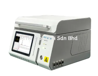
The Topcon CR-P1 3D Laser Scanner may be considered for reality capture applications involving existing building surveys, renovation planning and as-built documentation, subject to verified instrument capabilities and project requirements.
This guide explains how 3D laser scanning supports renovation projects in Malaysia, how an as-built survey is planned and what buyers should consider before selecting scanning equipment.
What Is an Existing Building Survey?
An existing building survey is a measurement and documentation process used to record the current physical condition and geometry of a building.
The survey may include:
Building floor layouts.
Room dimensions.
Wall positions.
Columns and beams.
Floor and ceiling geometry.
Doors and windows.
Staircases and corridors.
Visible mechanical and electrical services.
Accessible structural features.
Other relevant architectural elements.
The required information depends on the renovation scope.
An existing building survey is not automatically a structural condition assessment, concealed services investigation or certification of building compliance.
Why Existing Building Measurements Matter Before Renovation
Renovation design based on outdated drawings can create costly coordination problems.
For example, a proposed partition may conflict with an existing column, or a planned equipment installation may not fit the available space.
Incorrect floor levels or ceiling dimensions may also affect interior design and building services coordination.
Reliable existing building documentation can help project teams identify geometric constraints before construction.
The main benefits include:
Better renovation planning.
More reliable design references.
Improved coordination between consultants.
Reduced uncertainty about visible building geometry.
Support for as-built drawings.
Improved communication between project stakeholders.
These benefits depend on the quality and completeness of the survey.
How 3D Laser Scanning Supports Renovation Projects
A 3D laser scanner collects spatial measurements from visible surfaces within its measurement path.
The resulting point cloud can provide a detailed geometric reference for the existing environment.
Unlike traditional measurement workflows that may record selected dimensions, laser scanning can capture extensive visible geometry for later review.
However, a point cloud still requires suitable registration, verification and processing before it can be relied upon for project deliverables.
The scanner does not automatically identify every building component, create a complete architectural drawing or reveal concealed construction details.
Topcon CR-P1 for Residential Renovation Surveys
Residential renovation projects may involve landed houses, apartments, condominiums and older residential buildings.
Typical measurement requirements include:
Existing room layouts.
Wall positions.
Door and window openings.
Ceiling heights.
Floor levels.
Staircase geometry.
Visible beams and columns.
Accessible service areas.
For example, a renovation contractor planning a major interior alteration may need reliable dimensions before preparing a proposed layout.
A registered point cloud can provide a reference for subsequent drafting and design work.
The suitability of the Topcon CR-P1 should be assessed against the property's size, access conditions and required measurement tolerances.
Topcon CR-P1 for Commercial Building Renovation
Commercial renovation projects may include offices, retail outlets, restaurants, hotels and mixed-use buildings.
These projects can involve complicated existing layouts and multiple building services.
A 3D as-built survey may help document:
Office partition arrangements.
Corridors and circulation areas.
Visible structural elements.
Ceiling geometry.
Shopfront openings.
Accessible service installations.
Equipment spaces.
Existing floor layouts.
The survey team should coordinate access with the building management and relevant contractors.
Sensitive areas, occupied spaces and restricted facilities may require special procedures.
Topcon CR-P1 for Factory Renovation and Building Extensions
Industrial renovation projects may require more extensive geometric documentation.
Factory owners may need to understand the existing building layout before installing machinery, modifying production lines or extending facilities.
Potential survey areas include:
Factory floor geometry.
Structural columns.
Visible overhead piping.
Exposed ductwork.
Accessible cable trays.
Equipment foundations.
Warehouse areas.
Existing production spaces.
Point cloud information may support planning and coordination, but it does not establish equipment condition or confirm the capacity of existing structural systems.
Industrial safety requirements must be reviewed before scanning.
The Topcon CR-P1 must not be assumed suitable for hazardous or explosive atmospheres without verified manufacturer approval and applicable certification.
What Is a 3D As-Built Survey?
A 3D as-built survey records the measured geometry of an existing building or completed construction.
The resulting information may be used to prepare:
Registered point clouds.
Existing floor plans.
Building elevations.
Cross sections.
As-built CAD drawings.
Engineering reference models.
BIM models.
Renovation design references.
The term as-built should not be interpreted as a guarantee that every concealed or inaccessible building element has been verified.
The survey scope and limitations must be clearly defined.
Step 1 - Define the Renovation Survey Requirements
Before scanning, the project team should identify what information is needed.
Important questions include:
Which rooms or floors require measurement?
Are exterior surfaces included?
What accuracy is required?
Are floor levels important?
Is an established coordinate system required?
Are CAD drawings needed?
Will the point cloud be used for BIM?
Which building elements must be documented?
What areas are inaccessible?
Defining the scope early helps avoid collecting unsuitable or incomplete data.
Step 2 - Review Existing Drawings and Site Information
Where available, review the existing architectural and engineering drawings.
These documents may help identify important survey areas.
However, older drawings should not automatically be treated as an accurate representation of current building conditions.
The survey team should identify modifications that may have occurred since the drawings were prepared.
Relevant information may include:
Existing floor plans.
Renovation records.
Building management restrictions.
Previous survey reports.
Known structural modifications.
Accessible utility and service information.
This review supports more effective field planning.
Step 3 - Conduct a Site Assessment
A site assessment helps identify access restrictions and measurement challenges.
For renovation projects, common obstacles include furniture, partitions, suspended ceilings, equipment and occupied spaces.
Surveyors should consider:
Room accessibility.
Safe instrument positions.
Obstructed surfaces.
Available working hours.
Building occupants.
Lighting and environmental conditions.
Restricted rooms.
Data confidentiality requirements.
A site assessment can also help identify where conventional measurements may be needed to supplement scanning.
Step 4 - Plan the Scanning Positions
Scanner positions should be planned to capture the required visible geometry.
For example, a building with several rooms may require different scanning positions in each room and connecting corridor.
The survey team should consider how individual scanning areas will be registered together.
Important factors include:
Sufficient scan coverage.
Suitable overlapping geometry.
Access between rooms.
Visibility of important surfaces.
Reference targets when applicable.
Safe instrument setup locations.
The required number of scans depends on the building layout, project requirements and verified scanner capabilities.
Step 5 - Establish Survey Control When Required
Some renovation surveys use a local reference system.
Other projects may require an established coordinate system or consistent references across multiple floors.
Survey control may be necessary when the project involves:
Large buildings.
Multiple floors.
Building extensions.
Coordination with external survey data.
Repeated construction surveys.
Engineering alignment requirements.
A total station may support control measurements when appropriate to the survey methodology.
For example, Topcon GM Series total stations can be considered for conventional control and coordinate measurement tasks, subject to their verified specifications.
The survey control method must satisfy the agreed project tolerances.
Step 6 - Capture the Existing Building Geometry
Once the survey plan is established, the scanning team can collect the required spatial information using the manufacturer's approved operating procedures.
Important areas may include:
Walls and partitions.
Floors and ceilings.
Columns and beams.
Door and window openings.
Staircases.
Visible service installations.
Equipment clearances.
Connecting spaces.
The Topcon CR-P1 operating procedure, scanning settings and supported accessories must be confirmed from official manufacturer documentation.
Do not assume any unverified automatic scanning, registration or measurement functions.
Step 7 - Check for Missing Areas
Before leaving the building, the survey team should check whether the required areas have been captured.
Typical questions include:
Are all required rooms covered?
Are important wall surfaces visible?
Have major openings been documented?
Are staircases adequately captured?
Are there significant gaps caused by furniture?
Have reference measurements been recorded?
Are any areas inaccessible?
If critical geometry is missing, additional scanning positions or independent measurements may be necessary.
Software cannot turn unmeasured geometry into verified survey information.
Step 8 - Register and Process the Point Cloud
Individual scans may need to be aligned into a common spatial reference.
This process is known as point cloud registration.
Registration may use overlapping geometry, supported reference targets, survey control or other suitable methods.
The processed dataset should be checked for:
Alignment consistency.
Coordinate reference accuracy.
Missing geometry.
Unwanted points.
Registration errors.
Data completeness.
Exact Topcon CR-P1 software compatibility and registration procedures must be confirmed with current manufacturer documentation.
Step 9 - Verify Important Building Dimensions
Quality control is essential before point cloud information is used for renovation design.
Surveyors may compare selected dimensions against independent reference measurements.
Examples include:
Representative room dimensions.
Distances between structural features.
Floor level references.
Important equipment clearances.
Control point coordinates.
Critical opening dimensions.
The verification procedure should match the project accuracy requirements.
Point cloud density alone does not establish measurement accuracy.
Step 10 - Prepare the Required As-Built Deliverables
After processing and verification, the point cloud may be used to prepare the agreed deliverables.
Possible outputs include:
Existing building floor plans.
Room layout drawings.
Building elevations.
Cross sections.
As-built CAD drawings.
Registered point cloud datasets.
Scan-to-BIM models.
Renovation coordination references.
A point cloud is not automatically a finished CAD drawing or BIM model.
Drafting, modelling, interpretation and quality checking may be required.
The final deliverables should clearly identify any incomplete or inaccessible areas.
3D Laser Scanning vs Traditional Building Measurement
Traditional building measurement may involve tape measures, laser distance meters, levels and total stations.
These tools remain useful for many renovation projects.
Traditional methods may be suitable when:
Only a few dimensions are required.
The survey area is small.
A simple layout is sufficient.
The project does not require extensive geometric documentation.
3D laser scanning may be considered when:
The building has complex geometry.
Many visible surfaces require documentation.
Multiple rooms or floors must be recorded.
Point cloud data is needed for design coordination.
The client requires a Scan-to-BIM workflow.
Future geometric review may be valuable.
The best method depends on project complexity, accuracy requirements, available resources and deliverables.
A combined workflow may also be appropriate.
How 3D Scanning Supports Architects and Interior Designers
Architects and interior designers often need a reliable understanding of existing spaces before preparing renovation proposals.
A registered point cloud can provide geometric references for:
Space planning.
Partition design.
Ceiling layout coordination.
Opening dimensions.
Interior fit-out planning.
Existing architectural documentation.
However, designers must still interpret the measured geometry and verify important dimensions.
Scanning does not replace architectural judgment or statutory design requirements.
How 3D Scanning Supports M&E Renovation
Mechanical and electrical renovation projects may involve existing ductwork, piping, cable trays and equipment spaces.
Where these components are visible and accessible, scanning can support geometric documentation.
The resulting point cloud may help engineers review potential spatial conflicts during design.
However, scanning does not directly identify concealed wiring, hidden piping, electrical circuit functions or service condition.
Additional inspections and engineering investigations may be necessary.
How 3D Scanning Supports Building Extensions
Building extensions require careful coordination between existing and proposed construction.
Potential measurement requirements include:
Existing structural grid references.
Building levels.
Column positions.
Wall locations.
External geometry.
Connection areas.
Access and clearance constraints.
Survey control and independent verification may be particularly important when new construction must connect to existing structures.
The survey team should ensure that the measurement method meets the project's engineering requirements.
Common Problems in Existing Building Surveys
Problem 1 - Outdated Building Drawings
Existing drawings may not reflect previous renovation work.
Solution: Verify relevant geometry through a current survey.
Problem 2 - Furniture and Equipment Obstructions
Objects may block walls, floors or service areas.
Solution: Plan additional viewpoints and document inaccessible surfaces.
Problem 3 - Complex Building Geometry
Staircases, irregular walls and multiple floor levels may require careful scanning and registration.
Solution: Establish a suitable survey plan and verify critical dimensions.
Problem 4 - Incorrect Scan Registration
Misaligned scans can affect floor plans and measured dimensions.
Solution: Review registration quality and use suitable independent checks.
Problem 5 - Unclear Survey Scope
Clients may expect drawings or BIM models when only a point cloud was included.
Solution: Define deliverables and responsibilities before starting work.
Problem 6 - Hidden Building Services
Concealed pipes and cables are not directly visible to conventional optical scanning.
Solution: Use appropriate complementary investigation methods where required.
Problem 7 - Incomplete Data Processing
Raw scan data may not be immediately suitable for design applications.
Solution: Plan sufficient registration, processing and verification work.
Problem 8 - Incorrect Accuracy Expectations
A detailed point cloud may still contain measurement uncertainty.
Solution: Agree on project tolerances and quality control procedures.
Can 3D Laser Scanning Reduce Renovation Measurement Errors?
A properly planned scanning workflow can provide extensive geometric information and reduce dependence on incomplete manual measurement records.
However, it does not eliminate all measurement errors.
Survey quality still depends on:
Instrument suitability.
Correct field procedures.
Sufficient coverage.
Appropriate survey control.
Reliable registration.
Independent verification.
Suitable processing.
Clear project requirements.
Scanning should be treated as a measurement method requiring professional quality control, not an automatic guarantee of accuracy.
Who Should Consider a 3D Laser Scanner for Renovation Work?
Potential users include:
Land surveying contractors.
Building survey teams.
Architectural consultants.
Interior design companies.
Renovation contractors.
Engineering consultants.
BIM service providers.
Industrial facility survey teams.
Construction companies.
Building asset management teams.
The decision to purchase a scanner should consider expected project demand, staff capability, processing resources and long-term operating requirements.
Not every renovation contractor needs to own a 3D laser scanner.
For occasional projects, engaging a specialist scanning service provider may be more practical.
What to Check Before Buying the Topcon CR-P1 in Malaysia
Before selecting the Topcon CR-P1, buyers should confirm:
Official measurement accuracy specifications.
Supported operating distances.
Suitable project applications.
Scanning workflow requirements.
Software compatibility.
Supported data formats.
Registration methods.
Computer processing requirements.
Training availability.
Warranty conditions.
Service arrangements.
Product supply availability.
All technical capabilities should be verified using current official Topcon documentation.
Buyers should also consider whether a total station, laser distance meter or combined surveying workflow would better meet their needs.
Topcon CR-P1 Malaysia - Product Enquiries
MTM Precision Sdn Bhd supplies surveying instruments and provides surveying instrument service and calibration support in Malaysia.
Architects, renovation contractors, surveying companies, construction firms and engineering consultants interested in the Topcon CR-P1 3D Laser Scanner may contact MTM Precision to discuss their intended applications.
Enquiries may include existing building measurement, renovation surveys, as-built documentation, factory layout scanning and Scan-to-BIM equipment selection.
Product availability, quotation arrangements, software compatibility, supply conditions and applicable technical support are subject to confirmation.
The Topcon CR-P1 is not represented as a ready-stock product at MTM Precision.
Frequently Asked Questions
Q1. What is a 3D as-built survey?
A 3D as-built survey documents the measured geometry of an existing building or completed construction, often using point cloud data and other surveying methods.
Q2. Can the Topcon CR-P1 be used for renovation surveys?
The Topcon CR-P1 may be considered for reality capture applications, subject to verified manufacturer capabilities and project requirements.
Q3. Why is laser scanning useful before renovation?
Laser scanning can document extensive visible building geometry and provide a reference for renovation planning and design coordination.
Q4. Can a 3D laser scanner replace traditional building measurements?
Not in every situation. Conventional measurement tools and total stations may remain appropriate for selected dimensions, control measurements and verification.
Q5. Can a point cloud be converted into an as-built drawing?
Point clouds can support the preparation of as-built drawings, but drafting, interpretation and verification are normally required.
Q6. Can 3D laser scanning detect hidden pipes or electrical cables?
No. Conventional optical laser scanning captures visible surfaces and cannot directly detect concealed building services.
Q7. Is 3D scanning suitable for old buildings in Malaysia?
It may be useful for documenting accessible existing geometry, particularly where original drawings are incomplete or outdated.
Q8. Can laser scanning help with interior design projects?
Yes. Point clouds can provide geometric references for space planning and interior fit-out design, subject to appropriate processing and verification.
Q9. Can the Topcon CR-P1 support Scan-to-BIM?
The CR-P1 may be considered for reality capture workflows. Exact software compatibility and project suitability must be verified.
Q10. How accurate is a 3D laser scanner for renovation work?
Accuracy depends on the instrument, operating conditions, survey control, registration and processing. Official model specifications and project tolerances must be reviewed.
Q11. How many scans are required for a building?
The number depends on building layout, obstructions, required coverage and the instrument's verified capabilities.
Q12. Can 3D laser scanning be used for factory renovation?
It may support documentation of accessible factory geometry, subject to site safety and instrument operating limitations.
Q13. Is the Topcon CR-P1 available from ready stock at MTM Precision?
No ready-stock claim is made. Customers should contact MTM Precision to confirm availability and supply arrangements.
Q14. Where can I enquire about the Topcon CR-P1 in Malaysia?
Contact MTM Precision Sdn Bhd in Puchong, Selangor, to discuss project requirements and request product information or quotation arrangements.
Contact MTM Precision
MTM Precision Sdn. Bhd.
Showroom & Service Centre
No. 29-1 & 29-2, Jalan Bandar 18,
Pusat Bandar Puchong,
47160 Puchong, Selangor, Malaysia.
Website: www.mtmpre.com.my
Email: mtmpre@yahoo.com
WhatsApp: +6016-660 7346
MTM Precision welcomes surveying instrument enquiries from Kuala Lumpur, Selangor, Johor, Penang, Perak, Negeri Sembilan, Melaka, Pahang, Terengganu, Kelantan, Kedah, Perlis, Sabah and Sarawak.
SEO Meta Description
Topcon CR-P1 renovation and as-built survey guide Malaysia. Learn 3D laser scanning for existing buildings, floor plans, renovation and BIM.
Internal Linking Suggestions
1. Topcon CR-P1 3D Laser Scanner Malaysia - Features, Applications and Buying Guide
2. Topcon CR-P1 3D Laser Scanner for Building Survey and As-Built Documentation Malaysia
3. Topcon CR-P1 for BIM and Scan-to-BIM Projects Malaysia
4. Topcon CR-P1 for Construction Site Survey and Progress Documentation Malaysia
5. Topcon CR-P1 for Industrial Plant and Factory 3D Scanning Malaysia
6. Topcon CR-P1 vs Total Station Malaysia - Which Surveying Instrument Should You Choose?
7. How to Choose a 3D Laser Scanner for Surveying and Construction Malaysia - Topcon CR-P1 Buying Guide
8. How to Use a 3D Laser Scanner for Building and Construction Surveys Malaysia - Topcon CR-P1 Workflow Guide
9. Topcon CR-P1 Point Cloud Registration and Data Processing Malaysia - Common Problems and Solutions
10. Topcon CR-P1 3D Laser Scanning Accuracy Malaysia - Common Measurement Errors and Quality Control
11. Topcon GM-55 vs GM-65 Total Station Malaysia
12. Topcon GM-55, GM-62 and GM-65 Ready Stock Malaysia
13. Topcon GT-1201 Robotic Total Station Malaysia
14. Total Station Calibration Malaysia
15. Total Station Repair and Service Malaysia
16. 3D Laser Scanner Malaysia - Complete Buying Guide
27 Oct 2026


