







SingularXYZ TS1000 for Land Surveying Malaysia | Professional Total Station Guide - MTM Precision

SingularXYZ TS1000 for Land Surveying Malaysia - Professional Total Station and Surveying Equipment Guide
SingularXYZ TS1000 for Land Surveying Malaysia
Are you looking for a Total Station for Land Surveying Malaysia for topographic surveys, engineering surveys, construction-related measurements or survey control observations?
A total station is an optical surveying instrument used to measure horizontal angles, vertical angles and distances.
Professional surveying teams use total stations as part of workflows involving site measurements, coordinate observations and engineering reference information.
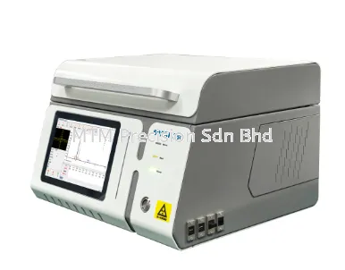
The SingularXYZ TS1000 Total Station is a manual optical total station that may be evaluated for suitable professional surveying applications.
The manufacturer's published product information identifies 2-second angular accuracy, together with prism and reflectorless distance measurement capabilities.
However, a manufacturer's technical specification does not automatically establish that an instrument is suitable for every professional surveying task.
Equipment selection should consider project accuracy requirements, survey control, measurement methods, environmental conditions and applicable professional standards.
MTM Precision Sdn Bhd supplies surveying instruments and related measurement equipment in Malaysia.
Customers in Selangor, Kuala Lumpur, Johor, Penang and throughout Malaysia can contact MTM Precision for product information, equipment selection enquiries and quotations.
What Is Land Surveying?
Land Surveying involves measuring and documenting positions, distances, directions and physical features associated with land and development projects.
Different surveying activities may require different measurement methods, instruments and professional procedures.
Examples include:
Topographic surveying
Engineering surveying
Construction surveying
Survey control observations
Site measurement
Infrastructure surveying
Land development measurement
Mapping-related field observations
The appropriate surveying equipment depends on the purpose of the survey and the required technical standards.
A total station is one of several instruments used in professional surveying.
Why Total Stations Are Used for Land Surveying
Total Stations combine electronic angular measurement and distance measurement in a single instrument.
They may be used where optical observations between an instrument and a target are appropriate.
Potential surveying applications include:
Horizontal angle measurement
Vertical angle measurement
Distance measurement
Coordinate observations
Topographic data collection
Engineering reference measurement
Survey control observations
However, the quality of surveying results depends on more than the instrument's published specifications.
Important factors include:
Survey control quality
Instrument setup
Target positioning
Observation distance
Atmospheric conditions
Measurement procedures
Instrument condition
Operator training
Professional surveying work should follow applicable technical and regulatory requirements.
SingularXYZ TS1000 Total Station Overview
The SingularXYZ TS1000 is a manual optical total station designed for professional surveying applications.
The manufacturer identifies the TS1000 as having a 2-second angular accuracy specification.
The manufacturer also describes reflectorless and prism-based distance measurement capabilities.
These characteristics make the TS1000 relevant for evaluation by surveying organisations seeking an optical measurement instrument.
However, suitability for a particular project must be established by comparing the instrument's verified specifications with the required surveying procedures and accuracy requirements.
The TS1000 should not be assumed to satisfy every statutory or cadastral surveying requirement in Malaysia.
1. SingularXYZ TS1000 for Topographic Survey Malaysia
Topographic Surveying involves measuring and documenting physical features and elevation-related information associated with a site.
Topographic surveys may support:
Land development planning
Engineering design
Construction planning
Infrastructure projects
Site documentation
Terrain-related measurement
Existing feature surveys
Total stations may be used for suitable optical observations within a topographic surveying workflow.
The SingularXYZ TS1000 may be evaluated for topographic surveying tasks where its published measurement capabilities satisfy the project requirements.
However, a complete topographic survey may involve additional equipment, control information and data processing methods.
The instrument alone does not determine the completeness or accuracy of the final survey deliverables.
2. SingularXYZ TS1000 for Engineering Survey Malaysia
Engineering Surveying supports the measurement requirements of construction, infrastructure and industrial development projects.
Potential applications include:
Engineering site measurement
Structural reference observations
Infrastructure surveying
Construction control measurement
Road and drainage surveying
Building development projects
Engineering coordinate observations
A Total Station for Engineering Survey Malaysia should be selected according to the required measurement tolerances and intended workflow.
The TS1000 may be considered for suitable engineering surveying tasks.
However, professional users must verify that its capabilities meet the project's technical requirements.
3. Survey Control and Coordinate Measurement
Survey Control provides the reference framework used to relate field observations to a defined coordinate system.
Reliable survey control is essential for consistent surveying measurements.
Survey control considerations may include:
Reference point stability
Coordinate system requirements
Survey datum
Control network quality
Measurement verification
Observation consistency
Applicable surveying procedures
Even a total station with a tight angular accuracy specification cannot compensate for unreliable survey control.
Professional surveyors should follow the applicable procedures for establishing, verifying and maintaining survey control.
4. Understanding 2 Second Angular Accuracy
Angular Accuracy is one of the main specifications used when evaluating total stations.
The SingularXYZ TS1000 has a manufacturer-specified angular accuracy of 2 seconds.
An arcsecond is a unit of angular measurement equal to 1/3600 of one degree.
A 2-second specification describes nominal angular measurement accuracy under applicable test conditions.
However, this does not mean that every measured coordinate will have an accuracy of 2 mm.
Coordinate accuracy depends on the complete measurement process.
Factors affecting results may include:
Angular measurement uncertainty
Distance measurement uncertainty
Instrument centring
Target centring
Survey control
Observation distance
Environmental conditions
Measurement procedures
Buyers should consider the complete measurement requirements rather than selecting a total station based only on angular accuracy.
5. Distance Measurement Accuracy for Land Surveying
Distance Measurement Accuracy is separate from angular accuracy.
A total station uses electronic distance measurement to determine the distance between the instrument and a suitable target.
Manufacturers commonly express distance accuracy using a fixed component and a distance-dependent component.
The applicable specification may vary according to the measurement mode and conditions.
For professional land surveying, buyers should review:
Prism distance measurement accuracy
Reflectorless distance measurement accuracy
Measurement range
Target requirements
Environmental limitations
Applicable manufacturer qualifications
A longer published measurement range does not automatically indicate tighter distance accuracy.
6. Reflectorless vs Prism Measurement for Land Surveying
A professional surveying workflow may involve different distance measurement methods.
Reflectorless Measurement
Reflectorless Total Station Measurement allows distance measurement to suitable surfaces without positioning a conventional prism at every target.
Potential applications include selected building surfaces, engineering features and suitable inaccessible targets.
However, reflectorless measurement depends on target characteristics and environmental conditions.
Prism Measurement
Prism-Based Total Station Measurement uses a compatible surveying reflector positioned at the target.
Prism observations are commonly used in professional optical surveying workflows.
The appropriate measurement method depends on the required accuracy, target conditions and applicable surveying procedures.
Comparison
Selection factorReflectorless measurementPrism measurementTargetSuitable surfaceCompatible surveying reflectorMain considerationSurface reflectivity and geometryReflector positioning and configurationMeasurement rangeInstrument and target dependentInstrument and reflector dependentAccuracyManufacturer-specificManufacturer-specificSurvey suitabilityRequires target assessmentRequires reflector and project assessment
Neither method is universally superior.
7. Reflectorless Measurement Limitations
Reflectorless Measurement can be affected by several factors.
Target Reflectivity
Different materials reflect measurement signals differently.
Surface Colour and Texture
Target characteristics may influence the returned measurement signal.
Measurement Geometry
Target orientation may affect the observation.
Environmental Conditions
Rain, mist, dust and other atmospheric conditions may influence optical measurements.
Background Interference
Objects near or behind the intended target may complicate measurement interpretation.
Measurement Distance
Maximum published measurement range should not be interpreted as guaranteed working distance.
Surveyors should evaluate whether reflectorless observations are appropriate for the intended task.
8. Total Station vs GNSS RTK for Land Surveying Malaysia
Total Stations and GNSS RTK Receivers are different surveying technologies.
A total station uses optical angle and distance measurement.
GNSS RTK equipment uses satellite positioning observations together with appropriate correction information.
Both technologies may be relevant to professional surveying workflows.
Total Station Considerations
Total stations may be appropriate where optical measurements and line of sight are available.
GNSS RTK Considerations
GNSS RTK may be appropriate for suitable satellite-based positioning tasks with adequate satellite visibility and correction support.
Combined Surveying Workflows
Some surveying organisations use optical and GNSS equipment within the same project.
However, equipment compatibility and software workflows must be verified.
The SingularXYZ TS1000 is an optical total station, not an integrated GNSS RTK receiver.
GNSS surveying requires separate suitable equipment.
9. SingularXYZ TS1000 and SingularPad Software
The manufacturer describes the TS1000 in connection with SingularPad Field Surveying Software.
Software workflow is an important consideration for professional surveying organisations.
Buyers should confirm:
Supported software version
Controller requirements
Communication configuration
Data collection workflow
Required project formats
Software licensing
Existing equipment compatibility
Training requirements
A particular software feature should not be assumed to be available for every instrument or controller configuration.
Customers should verify the exact proposed workflow before purchasing.
10. Professional Land Surveying Requirements Malaysia
Professional surveying activities in Malaysia may be subject to applicable laws, professional requirements, project specifications and technical standards.
For example, statutory or cadastral surveying may require compliance with procedures established by relevant authorities and professional bodies.
The use of a particular total station does not automatically establish compliance.
Before selecting surveying equipment, professional users should confirm:
Applicable surveying regulations
Project technical requirements
Required measurement accuracy
Survey control requirements
Instrument verification requirements
Approved measurement procedures
Professional responsibilities
Customers should consult the relevant Malaysian authorities or qualified surveying professionals where necessary.
MTM Precision's equipment information should not be interpreted as professional approval for statutory surveying applications.
11. Total Station Measurement Limitations
Professional surveyors should understand the limitations of optical measurement equipment.
Line of Sight
Total stations require an appropriate optical observation path to the target.
Instrument Setup
Instrument positioning and levelling can influence measurement quality.
Target Positioning
Target centring and stability are important for suitable surveying observations.
Atmospheric Conditions
Environmental factors may influence optical measurements.
Survey Control
Unreliable control information can affect the quality of resulting coordinates.
Instrument Condition
Damaged or poorly maintained instruments may require inspection.
Operator Experience
Training and appropriate surveying procedures remain essential.
These are general surveying considerations, not verified TS1000-specific defects.
12. Total Station Safety for Land Surveying
Land Surveying Safety is important when working on construction sites, roadsides, industrial premises and undeveloped land.
Surveying personnel should follow applicable workplace safety requirements and manufacturer instructions.
Important considerations include:
Safe instrument placement
Awareness of vehicles and machinery
Restricted working areas
Uneven terrain
Weather conditions
Appropriate personal protective equipment
Optical and laser safety requirements
Communication with site personnel
The TS1000's exact laser safety classification and operating precautions should be verified using official manufacturer documentation.
Surveying personnel should not disregard site restrictions or safety procedures to obtain measurements.
13. Total Station Accessories for Land Surveying
A complete Land Surveying Total Station Malaysia equipment package may require additional accessories.
Common purchasing considerations include:
Surveying tripod
Reflector prism
Prism pole
Tribrach
Battery
Charger
Carrying case
Field controller
Data communication accessories
Software requirements
The equipment package may vary by supplier and configuration.
Customers should request confirmation of included accessories.
Compatibility with existing equipment should be verified before purchasing.
14. Total Station Calibration Malaysia
A total station is a precision surveying instrument that requires appropriate maintenance and periodic assessment.
Total Station Calibration Malaysia may be relevant when:
Measurement results appear inconsistent
The instrument has experienced accidental impact
Equipment has been stored for an extended period
Project procedures require verification
Periodic maintenance is due
Inspection and calibration requirements depend on manufacturer guidance, equipment usage and project requirements.
MTM Precision Sdn Bhd handles surveying instrument inspection, calibration and repair enquiries through its Puchong location.
Customers should confirm the available service scope for the exact instrument model.
15. How to Choose a Total Station for Land Surveying
Before purchasing a Total Station for Land Surveying Malaysia, buyers should consider the following.
Identify the Surveying Application
Determine whether the instrument will be used for topographic surveying, engineering surveying, construction surveying or survey control observations.
Confirm Professional Requirements
Review the applicable technical and regulatory requirements.
Evaluate Angular Accuracy
Compare the manufacturer's published angular accuracy specification with the project requirements.
Review Distance Measurement Specifications
Consider prism and reflectorless measurement capabilities.
Assess Software Workflow
Confirm controller and data collection requirements.
Check Equipment Accessories
Request confirmation of the supplied package.
Review Inspection and Calibration Arrangements
Consider long-term instrument maintenance.
Confirm Warranty Terms
Request written warranty information.
Request a Complete Quotation
Provide the supplier with the intended application and equipment requirements.
16. Land Surveying Equipment Supplier Johor Malaysia
Land surveyors, engineering companies and construction contractors in Johor may require optical surveying instruments for land development, infrastructure and engineering projects.
MTM Precision welcomes Land Surveying Equipment Johor Malaysia enquiries.
Customers can contact our team regarding the SingularXYZ TS1000, equipment selection and quotation requirements.
Availability and delivery arrangements are subject to confirmation.
17. Land Surveying Equipment Supplier Penang Malaysia
Professional surveying and engineering organisations in Penang may require total stations for industrial facilities, construction developments and infrastructure projects.
Customers searching for Land Surveying Equipment Penang Malaysia can contact MTM Precision for surveying instrument information and quotations.
Equipment configurations and delivery arrangements should be confirmed before ordering.
18. Land Surveying Equipment Supplier Selangor and Kuala Lumpur
MTM Precision Sdn Bhd is located in Puchong, Selangor, Malaysia.
Customers searching for Land Surveying Equipment Supplier Selangor, Total Station Kuala Lumpur or Surveying Instruments Puchong can contact our team for product information and quotation enquiries.
Customers planning a showroom visit should confirm appointment arrangements and product availability in advance.
Frequently Asked Questions - SingularXYZ TS1000 for Land Surveying Malaysia
1. What is the SingularXYZ TS1000?
The SingularXYZ TS1000 is a manual optical total station designed for professional surveying applications.
2. Can the TS1000 be used for land surveying?
The TS1000 may be evaluated for suitable optical land surveying tasks where its specifications meet the applicable requirements.
3. Is the TS1000 suitable for topographic surveying?
It may be considered for suitable topographic survey observations, subject to project requirements and the complete surveying workflow.
4. Can the TS1000 be used for engineering surveying?
The instrument may be evaluated for suitable engineering surveying applications where its verified capabilities meet project requirements.
5. What is the angular accuracy of the SingularXYZ TS1000?
The manufacturer specifies 2-second angular accuracy.
6. Does 2-second angular accuracy mean 2 mm coordinate accuracy?
No. Angular accuracy and coordinate accuracy are different. Final coordinate accuracy depends on the complete measurement process.
7. Why is survey control important?
Survey control provides the reference framework used to relate surveying observations to a defined coordinate system.
8. What is the difference between reflectorless and prism measurement?
Reflectorless measurement uses suitable target surfaces, while prism measurement uses a compatible surveying reflector.
9. Can the TS1000 replace a GNSS RTK receiver?
The TS1000 and GNSS RTK equipment use different measurement technologies. Their suitability depends on the intended application.
10. Does the TS1000 support SingularPad?
SingularXYZ identifies SingularPad integration for the TS1000. The exact software and controller configuration should be confirmed.
11. Is the TS1000 automatically approved for cadastral surveying in Malaysia?
No. Compliance with statutory or cadastral surveying requirements must be independently verified.
12. What measurement limitations should surveyors consider?
Important considerations include line of sight, instrument setup, target conditions, atmospheric effects, survey control and instrument condition.
13. Does MTM Precision provide total station calibration enquiries?
Yes. Customers can contact MTM Precision regarding surveying instrument inspection and calibration, subject to confirmation of model-specific service availability.
14. Where can I enquire about SingularXYZ TS1000 in Malaysia?
Customers can contact MTM Precision Sdn Bhd in Puchong, Selangor, for product information and quotations.
15. How can I request a SingularXYZ TS1000 quotation?
Contact MTM Precision by WhatsApp, office telephone or email with your surveying application, equipment requirements and delivery location.
Why Contact MTM Precision?
MTM Precision Sdn Bhd supplies surveying instruments and related measurement equipment in Malaysia.
Customers can enquire about:
SingularXYZ TS1000 Total Station
Land Surveying Total Station Malaysia
2 Second Total Station Malaysia
Reflectorless Total Station Malaysia
Topographic surveying equipment
Engineering surveying instruments
Construction surveying equipment
Total station accessories
Surveying instrument inspection
Calibration and repair enquiries
Product quotations and availability
We welcome enquiries from land surveyors, engineering survey companies, construction contractors, infrastructure organisations and equipment purchasing departments.
Contact MTM Precision Sdn Bhd
MTM Precision Sdn Bhd
Puchong Showroom & Service Centre
No. 29-1 & 29-2, Jalan Bandar 18,
Pusat Bandar Puchong,
47160 Puchong, Selangor, Malaysia.
Website: https://www.mtmpre.com.my
WhatsApp / Mobile: +6016-6607346
Office Tel: +603-80807172
Email: mtmpre@yahoo.com
SingularXYZ TS1000 Product Page:
https://www.mtmpre.com.my/showproducts/productid/4364792/cid/0/singular-xyz-ts1000-total-station/
Contact MTM Precision to request a quotation or discuss your land surveying equipment requirements.
SEO Meta Description
SingularXYZ TS1000 for Land Surveying Malaysia. Explore topographic surveys, engineering measurement, survey control, accuracy and total station selection.
SEO Keywords
Primary Keywords:
SingularXYZ TS1000 for Land Surveying Malaysia, Land Surveying Total Station Malaysia, SingularXYZ TS1000 Malaysia, Total Station Supplier Malaysia, Professional Surveying Equipment Malaysia
Secondary Keywords:
Topographic Survey Total Station Malaysia, Engineering Survey Equipment Malaysia, Survey Control Total Station, 2 Second Total Station Malaysia, Reflectorless Total Station Malaysia, Total Station vs GNSS RTK Malaysia, Total Station Calibration Malaysia, Land Surveying Equipment Johor, Land Surveying Equipment Penang, Total Station Selangor, Surveying Instruments Puchong
Internal Linking
Existing MTM Precision Product Page:
SingularXYZ TS1000 Total Station Malaysia
https://www.mtmpre.com.my/showproducts/productid/4364792/cid/0/singular-xyz-ts1000-total-station/
Existing MTM Precision Topcon Buying Guide:
Where to Buy Topcon Total Station in Malaysia - GM-55, GM-62 and GM-65
https://www.mtmpre.com.my/latestnews/nid/215569/
MTM Precision Main Website:
Article 1 - Supporting Article:
SingularXYZ TS1000 Total Station Supplier Malaysia
Add the verified published article URL when available.
Article 2 - Supporting Article:
SingularXYZ TS1000 2 Second Total Station Malaysia
Add the verified published article URL when available.
Article 3 - Supporting Article:
SingularXYZ TS1000 Reflectorless Total Station 1000m Malaysia
Add the verified published article URL when available.
Article 4 - Supporting Article:
SingularXYZ TS1000 vs Topcon GM-65 Malaysia
Add the verified published article URL when available.
Article 5 - Supporting Article:
SingularXYZ TS1000 vs Topcon GM-62 Malaysia
Add the verified published article URL when available.
Article 6 - Supporting Article:
SingularXYZ TS1000 vs Sokkia iM-52 Malaysia
Add the verified published article URL when available.
Article 7 - Supporting Article:
How to Choose a 2 Second Total Station Malaysia
Add the verified published article URL when available.
Article 8 - Supporting Article:
Total Station for Construction Setting Out Malaysia
Add the verified published article URL when available.
Planned Supporting Articles - Add Links After Publication:
SingularXYZ TS1000 and SingularPad Software Malaysia
Reflectorless vs Prism Total Station Malaysia
Total Station Supplier Johor Bahru Malaysia
Total Station Supplier Penang Malaysia
Total Station Accuracy and Calibration Malaysia
Complete Guide to SingularXYZ TS1000 Total Station Malaysia
Manufacturer References
SingularXYZ TS1000 Official Product Page:
https://www.singularxyz.com/product_detail/TS1000
SingularXYZ TS1000 Technical Datasheet:
https://www.singularxyz.com/download-file/60
Technical specifications, software capabilities and operating limitations should be verified against the latest manufacturer documentation. Product configuration, stock, warranty and service availability are subject to confirmation. Professional surveying work must follow applicable technical, regulatory and project requirements.
15 Nov 2026


