




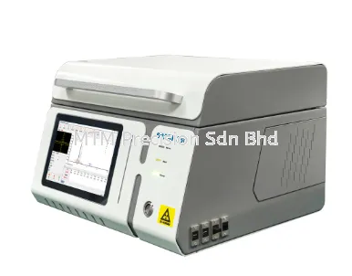


High-Performance Unmanned Vehicle & Deeply Coupled Navigation GNSS Receiver in Malaysia: The Toksurvey NET660i-1U GNSS Receiver

High-Performance Unmanned Vehicle & Deeply Coupled Navigation GNSS Receiver in Malaysia: The Toksurvey NET660i-1U GNSS Receiver
Across Malaysia's advanced autonomous driving, intelligent robotics, precision agriculture, and unmanned vehicle deployment sectors, engineers and system integrators require robust positioning receivers capable of maintaining high-accuracy tracking through urban canyons, signal blockages, and severe multipath environments
Core Engineering & System Characteristics
-
Linux Intelligent System: Built on an ARM Cortex-A7 1.8GHz processor and an embedded Linux operating system, delivering efficient onboard computing and unlimited functional expandability
-
All-System Dual-Frequency 1,507-Channel Tracking: Integrates an independent high-precision positioning module utilizing 1,507 channels to support comprehensive satellite signals across BDS, GPS, GLONASS, Galileo, QZSS, SBAS, and NavIC (IRNSS)
-
Built-In Deeply Coupled Navigation Algorithm: Combines an integrated MEMS inertial measurement unit with dead reckoning algorithms to provide continuous position and speed data during short-term signal obstructions, enhancing urban canyon positioning accuracy by 2 to 5 times compared to loosely coupled systems
-
Cloud Service Functionality: Regularly reports device status—such as location, network status, signal strength, and satellite reception—while supporting cloud platform functions for remote restarts, resets, and firmware upgrades
-
Versatile Protocol Compatibility: Supports Ntrip Client/Server/Caster, TCP Client/Server connections, FTP file transfers, HTTP/HTTPS, and MQTT transmission protocols
Comprehensive Technical Specifications
GNSS Performance & Positioning Accuracy
-
Channels & Tracking: 1,507 channels supporting GPS (L1C/A, L1C, L2, L5), GLONASS (L1, L2), BDS (B1I, B2I, B3I, B1C, B2a, B2b), Galileo (E1, E5a, E5b, E6), QZSS (L1, L2, L5, L6 CLAS), SBAS (L1C/A), and NavIC/IRNSS (L5)
-
Observation & Position Accuracy: Pseudorange observation accuracy <10.0cm, carrier phase observation accuracy <1.0cm, single point positioning horizontal precision of 1.5m and vertical precision of 2.5m
-
RTK & Static Precision: High-precision RTK accuracy of ±(10mm + 1ppm) horizontally and ±(15mm + 1ppm) vertically; static positioning accuracy of ±(2.5mm + 1ppm) horizontally and ±(5mm + 1ppm) vertically
-
Timing, Data Formats & Update Rates: Achieves <20ns time accuracy (excluding RF cable/antenna delays)
IMU & Accelerometer Parameters
-
IMU Specifications: Operates at 50/100Hz
-
Accelerometer Specifications: Measuring range of ±16g
Interfaces, Communication & Data Storage
-
Serial, USB & Network Ports: Equipped with a standard RS232 serial interface (supporting 1,200 to 230,400 bps baud rates)
-
Cellular & Physical Connectors: Full NetCom cellular communication covering LTE FDD, LTE TDD, WCDMA, and GSM bands
-
Onboard Storage: 32GB internal storage supporting multi-channel data storage
Electrical, Physical & Environmental Resilience
-
Electrical Characteristics: Operates on 9–24V DC external power input (12V typical) with a power dissipation of 18W
-
Enclosure & Dimensions: Housed in a durable magnesium alloy main body measuring 148.8mm × 105mm × 50.3mm and weighing 490g
-
Environmental Ratings: IP68 dustproof and waterproof protection
Key Applications Across Malaysian Industries
-
Unmanned Ground Vehicles & Autonomous Driving: Providing continuous, deeply coupled positioning and inertial navigation for self-driving platforms across complex urban and industrial environments
-
Intelligent Robotics & Smart Agriculture: Delivering reliable real-time position and posture data for autonomous agricultural machinery and robotic navigation
-
High-Dynamics Urban Navigation: Overcoming signal blockages and multipath interference in challenging environments via integrated MEMS inertial sensors
Local Technical Support and Expertise in Malaysia
Located in Puchong, Selangor, MTM Precision provides expert system consultation, integration guidance, and dependable local technical support for Toksurvey (TOKNAV) advanced navigation solutions across Malaysia
Contact MTM Precision
MTM Precision Sdn. Bhd.
Showroom & Service Centre
No. 29-1 & 29-2, Jalan Bandar 18,
Pusat Bandar Puchong,
47160 Puchong, Selangor, Malaysia
Email: mtmpre@yahoo.com
WhatsApp: +6016-660 7346
Office Tel: +603-80807172
14 Nov 2026


